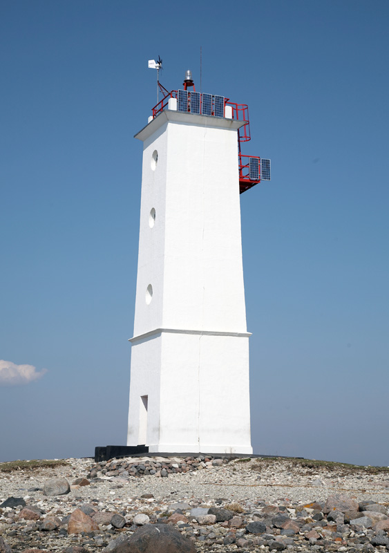
The lighthouse is located on the southern coast of Saaremaa, 18 km east of Kuressaare, on Cape Säaretük and helps to navigate the shipping route between Romesaare and the Great Strait.
The four-sided, 15 m high standard lighthouse made of stone concrete was built in 1954. The visibility distance of the acetylene lantern light with a circular sector 17 m above sea level was 9 miles and the nature of the light: Fl W 1.5 s; 0.5 + 1 = 1.5 sec.
1964. In 2008, the visibility distance of the Säaretuka lighthouse was marked as 8 miles. In the 1980s, the lighthouse was powered by a radioactive isotope generator. After the generator was removed in 1993, the lighthouse was without a light for a year.
1995. In 2018, new solar-wind powered lighting devices were installed on the lighthouse, the light characteristics of which were: Fl (2) W 10 s; 0.5 + 1 + 0.5 + 8 = 10 sec. The visibility of the fire was reduced to 7 miles (TM 1995, 12/464).
1999. year the nature of the fire was changed: Fl(3) W 15 s. Visibility reduced to 6 miles. The lighting device is a lantern ML-300 with a circular sector from the company Tideland Signal Ltd.